High Water Levels
High Water Levels in District
Wet conditions across the Nine Mile Creek Watershed District are causing high water levels in many District lakes. The National Weather Service is predicting approximately 2-inches of rain for the Nine Mile Creek watershed this weekend (May 17-19), which means that lake levels will continue to be high. If you have concerns about flooding at your residence due to high water, consider calling your city’s public works department to check on the availability of sandbags. The District is assisting its cities and partners by providing information to assess flood risk and make action plans.
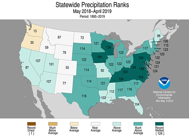
We are currently in a historically wet period. According to the Minnesota Department of Natural Resources State Climatology office, 2013-2018 was the wettest six-year period on record since the 1870s (when record keeping began). In addition, Minnesota had the fourth wettest 12-month period on record from May 2018-April 2019, illustrated below.