
Flood Mapping Tool
NMCWD has developed a flood mapping tool to help property owners assess flood risk on their properties.
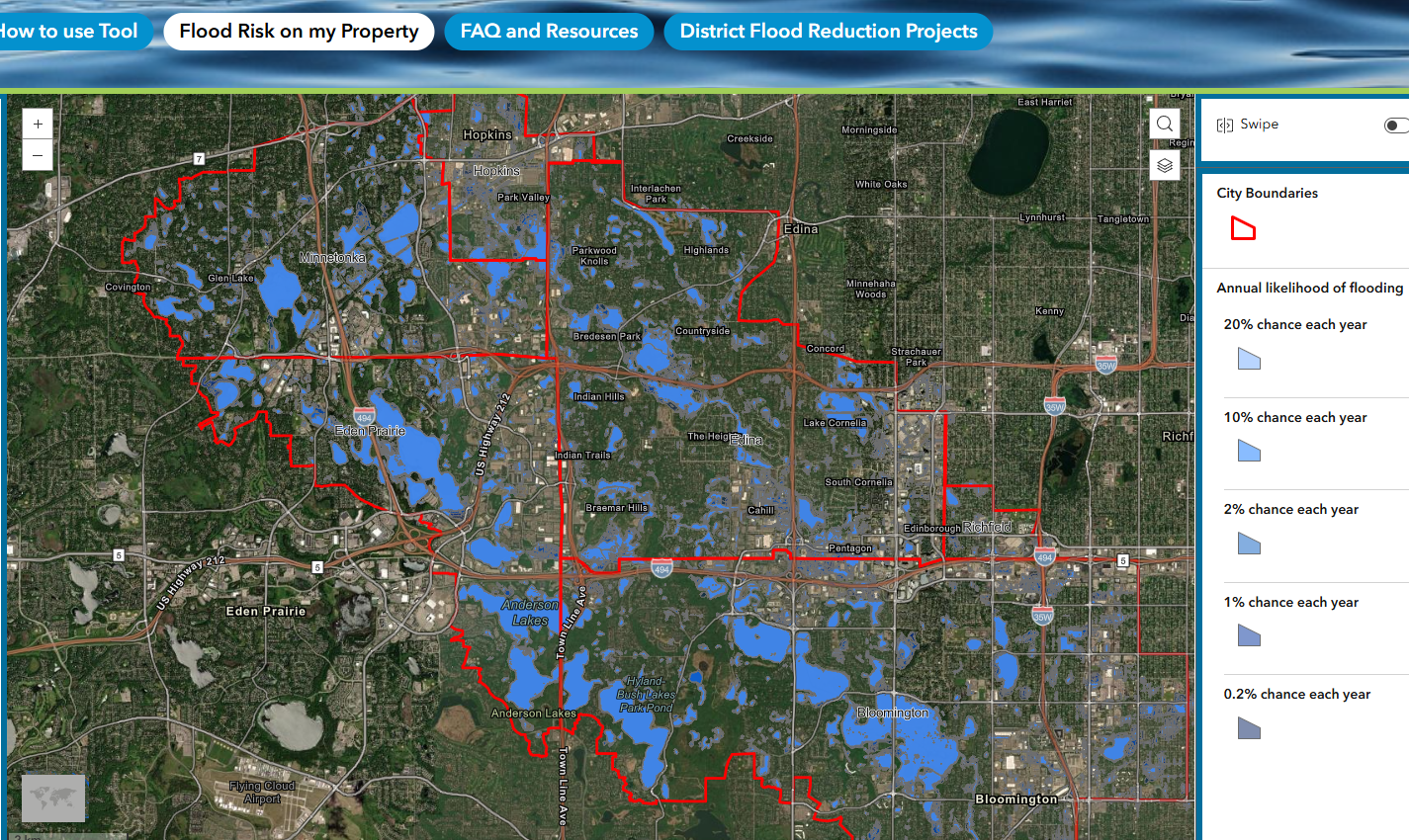 This tool shows the predicted extent of flooding within the Nine Mile Creek watershed under different sized rainstorms and snowmelt conditions.
The data shown is developed from stormwater models using Atlas 14 rainfall estimates from the National Oceanic and Atmospheric Administration (NOAA) and regional snow melt estimates. The flood extent information shown is an approximation and can be used as a first step to assess your flooding risk. There is also a frequently asked questions page and a page of project highlights related to flood reduction around the district.
This map only models surface water flooding, where water bodies rise and overflow their banks, or flash flooding of streets. It does not model sanitary backflow (sewer blockages) or groundwater seepage (where underground water rises naturally or due to storms). These mapped flooding extents have not been ground-truthed and may differ from actual experiences.
Please note that this tool is for general informational purposes only and should not be relied on for any official purpose.
Click the button below to visit the tool.
For questions, contact Education & Outreach Coordinator, Gael Zembal at gzembal@ninemilecreek.org or 952-658-9104.