
Bloomington
Nine Mile Creek got its name from early settlers in Minnesota. When they traveled west from Fort Snelling along Old Shakopee Road, the creek crossing was nine miles from the fort.
ABOUT NINE MILE CREEK
There are two branches of Nine Mile Creek. The source of the north branch is in Hopkins, and is groundwater and stormwater fed. Minnetoga Lake and the surrounding wetlands in Minnetonka feed the south branch. The two branches join north of Normandale Lake in Bloomington. Nine Mile Creek flows through Normandale Lake as it continues its journey to the Minnesota River. The name Nine Mile Creek is misleading because the main stem of the creek is actually 15 miles long. The south branch of the creek is 8.5 miles long.
Creek Monitoring
Because the primary use of Nine Mile Creek is a place for fish and aquatic life to live, the focus of the Nine Mile Creek monitoring program is evaluation of the stream’s fish and aquatic life community. 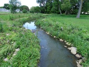
The Nine Mile Creek monitoring program includes:
- Monitoring of the fish community
- Macroinvertebrate monitoring
- Habitat monitoring
- Measurements of specific conductance, dissolved oxygen, pH, temperature, turbidity, and flow
Monitoring Results
The 2017 water quality, fish, and macroinvertebrate data indicate that despite urbanization impacts, water quality conditions in Nine Mile Creek from 1968 through 2017 have generally remained relatively stable over time. The stream stabilization projects completed and currently on-going have contributed to the improvements of fish numbers, quality of the fish community, and intolerant macroinvertebrates found in the creek. Monitoring will continue at the annual monitoring stations to maintain this long-term record of water quality and biota in Nine Mile Creek and to assess the biological community to determine changes in stream habitat or water quality that warrant further investigation or management measures.
Chloride Impairment
Nine Mile Creek has too much chloride in it. The chloride comes from salt used in the winter on roads, parking lots, and sidewalks. The levels of salt in the creek make the water unhealthy for the aquatic animals living there.
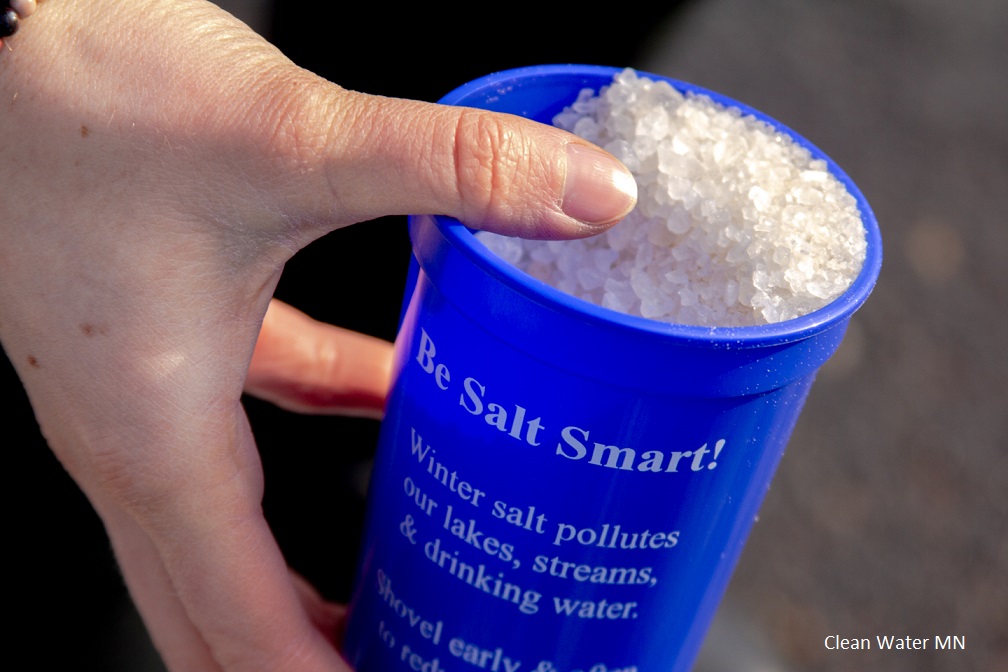 Nine Mile Creek is currently listed on the Minnesota Pollution Control Agency’s (MPCA) 303(d) Impaired Waters List because of chloride levels, as well as impaired biota due to low fish Index of Biotic Integrity (IBI) scores. The creek was first put on the impaired waters list in 2004 after data indicated that Nine Mile Creek had chloride levels in excess of the MPCA’s state water quality chronic standard of 230 milligrams per liter. In order for the creek to meet state water quality standards, there will need to be a reduction in chloride loadings of 62% across the watershed.
Nine Mile Creek Watershed Chloride TMDL (PDF)
Nine Mile Creek Watershed Chloride TMDL Project Overview (PDF)
The District has been working with multiple stakeholders to safely reduce the amount of chloride used in the winter through education, technology, and equipment upgrades. Through these efforts, significant reductions in chloride loadings to the creek have been made.
Creek Restoration Projects
Several streambank stabilization and restoration projects have been undertaken by the District to improve the water quality and ecological health of the creek. Learn more
The District recently completed a streambank stabilization project on Nine Mile Creek in the City of Edina. Learn more
Help the creek this spring!
Adopt a segment of the creek and clean the trash out of it. This volunteer program requires only one cleanup in early spring before the plants grow too tall. See which segments are available and sign up to adopt one here: Adopt a Creek