Minnetonka
ABOUT MINNETOGA LAKE
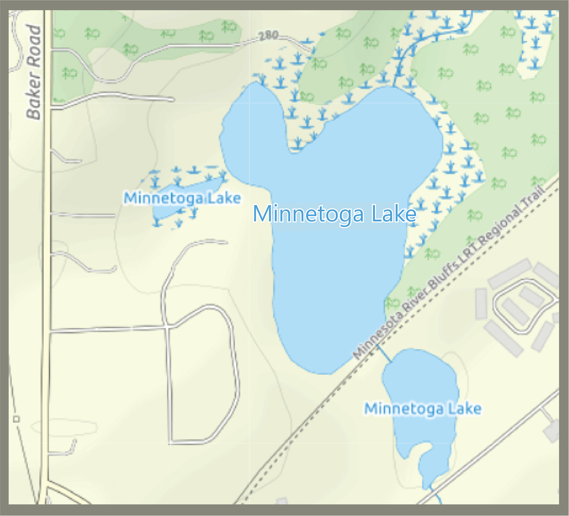
Minnetoga Lake, east of Interstate 494 in Minnetonka, is a shallow lake that has good water quality.
Water Quality
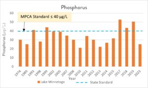
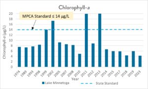
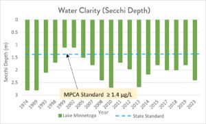
Water quality of Minnetoga Lake is fair, with chlorophyll-a and water clarity better than state standards. Phosphorus is the nutrient that fuels algae and plant growth. Too much phosphorus can lead to unwanted algae blooms in a lake. The higher levels of phosphorus in Minnetoga Lake is from stormwater nutrient loading and explains algal growth that can occur later in summer. The plant data collected by the District also show great diversity with at least 13 different plant species present. Nine Mile Creek Watershed District and the City of Minnetonka will continue to monitor lake health and adjust maintenance in the future if necessary. Minnetoga Lake is a Citizen-Assisted Monitoring Program (CAMP) lake. Citizen volunteers collect water samples which are analyzed by the Met Council. This data is used to supplement District monitoring data. Thank you to our CAMP volunteers.
Printable lake fact sheet
Past Projects
To maintain the health of Minnetoga Lake, in 2006, the Nine Mile Creek Watershed District installed three stormwater detention ponds and upgraded two additional ponding areas to stormwater detention ponds. These improvements were part of the larger Minnetonka Lakes Water Quality Improvement Project. The project’s goal was to reduce the amount of phosphorus entering the lake by filtering stormwater before it enters the lake. This project cemented Minnetoga Lake’s reputation as a healthy lake suitable for fishing and swimming.
For information about other past District projects, click here.
Shallow Lakes
Check out this story map to learn about what is so special about shallow lakes! To view the story map in a new browser window, click here.
Recreation

Minnetoga Lake has limited recreational opportunities, but the Minnesota River Bluffs LRT Regional Trail does pass along the lake for 0.1 miles.
The Minnesota Department of Natural Resources may have additional information on the lake (including fishing regulations; location; water access sites; lake maps; lake reports on stocking, ice in/out and water quality; fish consumption; and aquatic plant surveys) if so, that information can be found here:
https://www.dnr.state.mn.us/lakefind/index.html
Downloadable water quality data can be found here:
https://www.pca.state.mn.us/water/water-quality-data