Edina
ABOUT LAKE EDINA
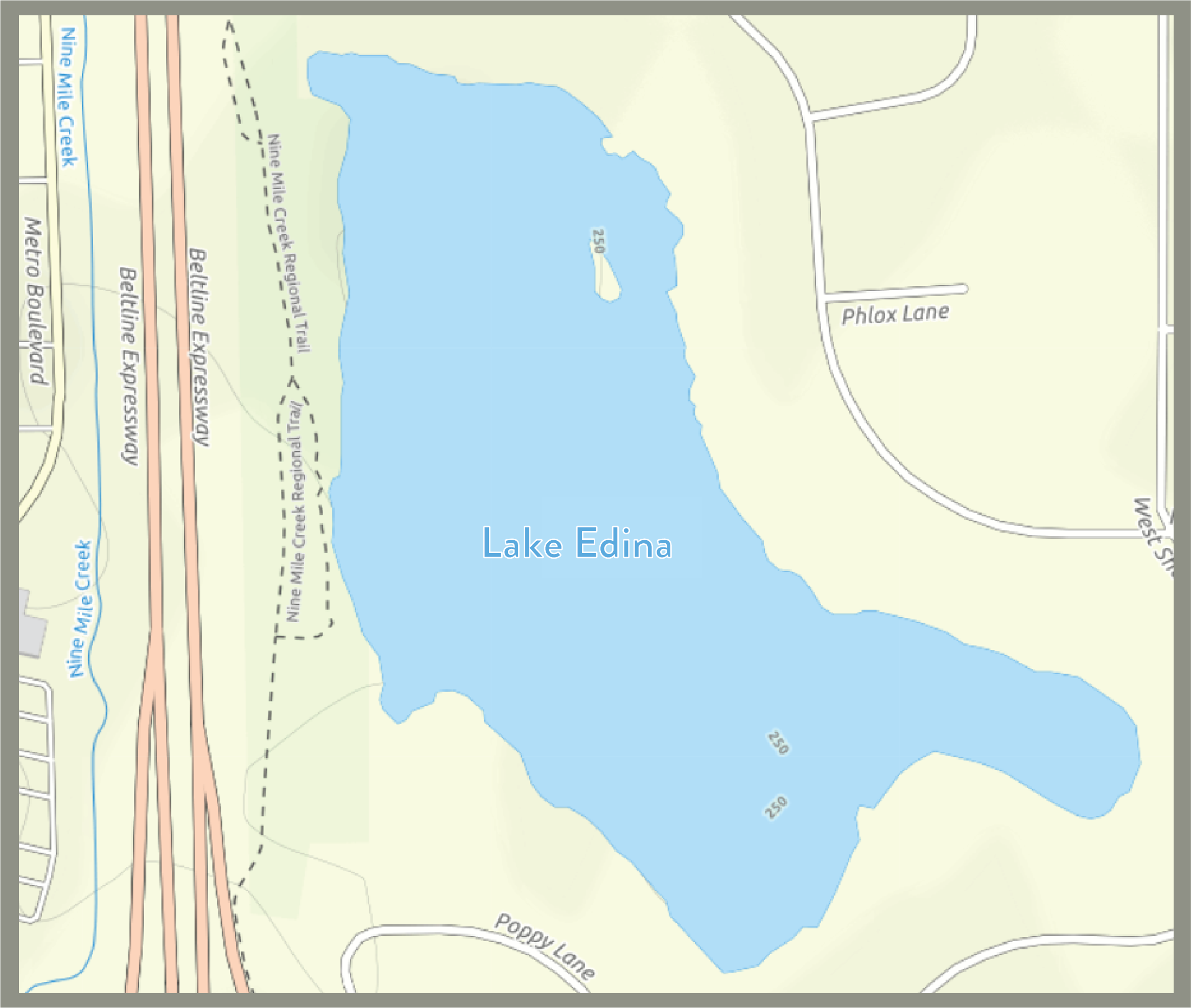
Lake Edina, east of Highway 100 in Edina, is a shallow lake that has poor water quality.

Water Quality

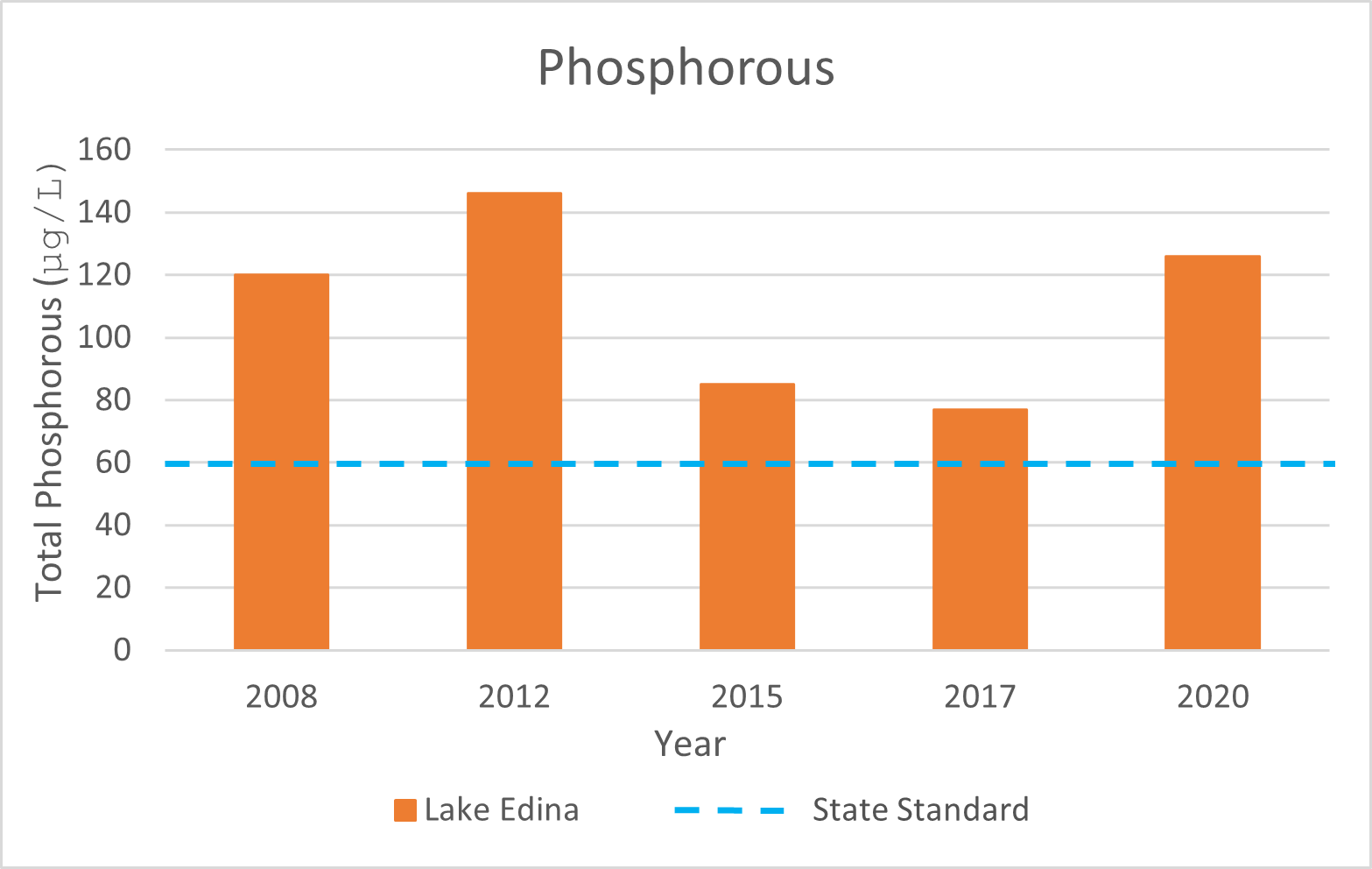
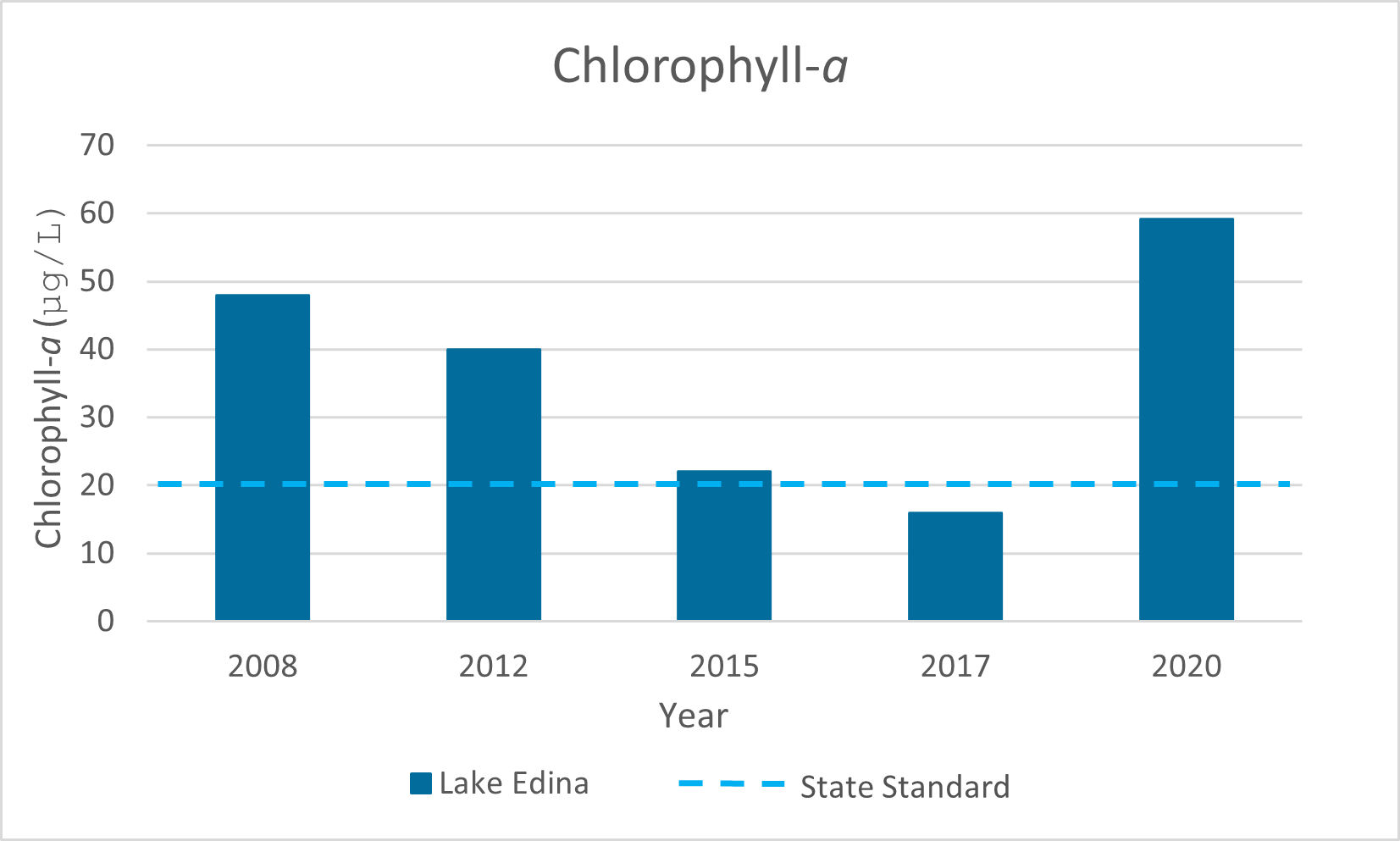
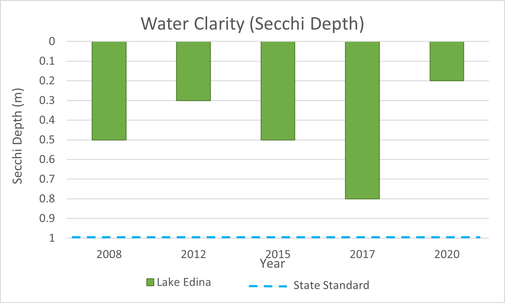
Water quality in Lake Edina is poor and does not meet state standards for shallow lakes. Phosphorus in Lake Edina comes from several sources. Stormwater runoff from the watershed and water flow from upstream Lake Cornelia are two of the biggest sources. Invasive aquatic plants curly-leaf pondweed and Eurasian watermilfoil also contribute to the poor water quality of Lake Edina.


Printable lake fact sheet
Current Projects
Water travels from Lake Cornelia to Lake Edina, so the water quality of Lake Cornelia directly impacts the health of Lake Edina. The Nine Mile Creek Watershed District is working to control nutrient levels (phosphorus) in the Lake Cornelia. The District conducted an alum treatment on Lake Cornelia in May 2020 to help control the level of phosphorus in the lakes. This project will work to improve the health of Lake Edina, as well as Lake Cornelia. The Nine Mile Creek Watershed District is currently looking into additional projects in the Lake Edina watershed that will work to improve the health of the Lake Edina.
For information about other past District projects, click here.
Recreation

Lake Edina has limited recreational opportunities, but the Nine Mile Creek Regional trail does pass along the lake for 0.3 miles.
The Minnesota Department of Natural Resources may have additional information on the lake (including fishing regulations; location; water access sites; lake maps; lake reports on stocking, ice in/out and water quality; fish consumption; and aquatic plant surveys) if so, that information can be found here:
https://www.dnr.state.mn.us/lakefind/index.html
Downloadable water quality data can be found here:
https://www.pca.state.mn.us/water/water-quality-data

