Eden Prairie
ABOUT BIRCH ISLAND LAKE
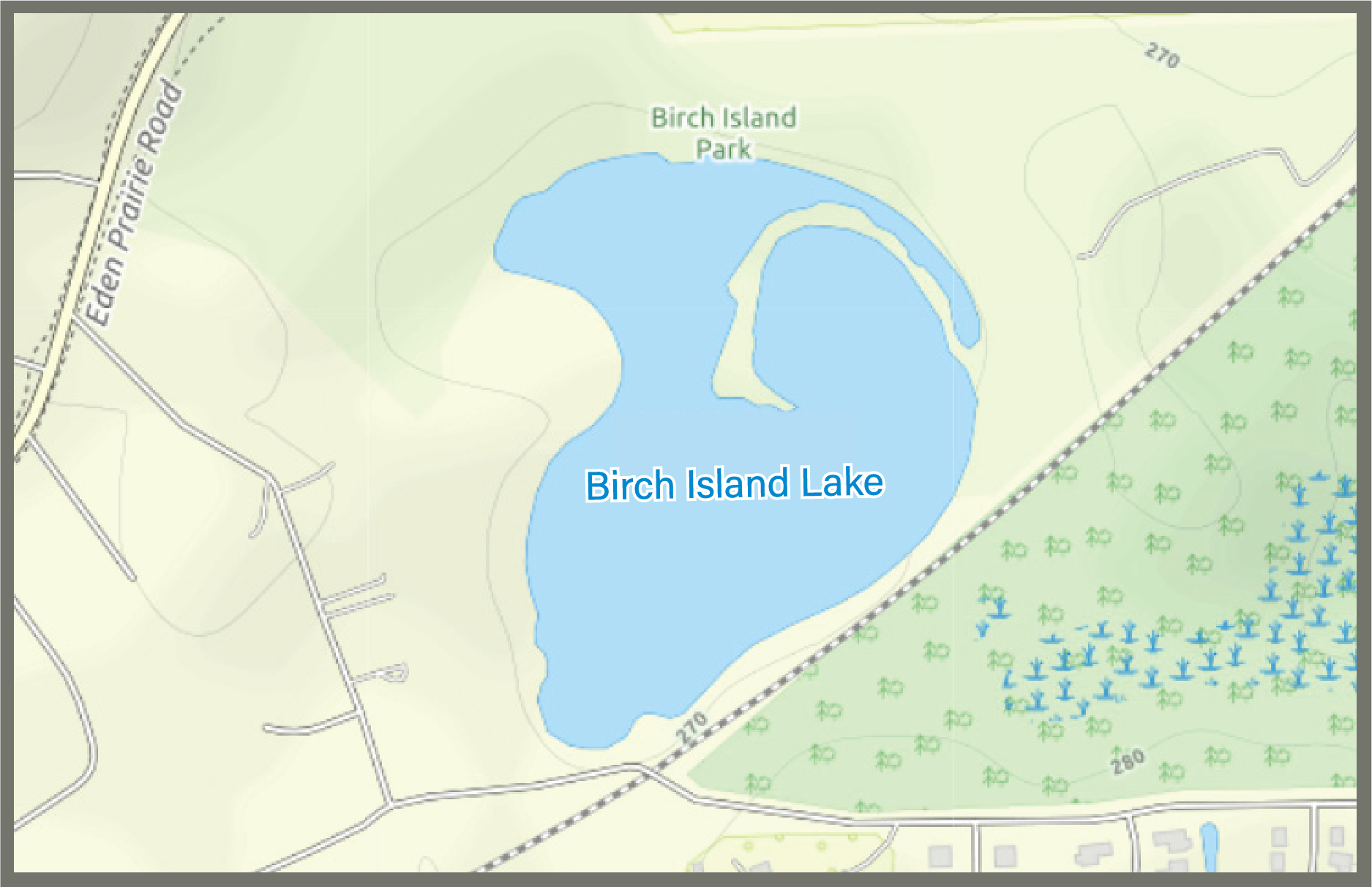
Birch Island Lake covers approximately 26.1 acres and has a maximum depth of about 14 feet, with an average depth of 2.5 feet. The lake is generally considered landlocked, meaning it has no confirmed surface outlet. As a result, water levels are primarily influenced by weather conditions, including rainfall, snowmelt, evaporation, and groundwater flow.
The lake’s direct watershed encompasses approximately 454 acres, including the lake itself. Stormwater reaches Birch Island Lake through overland runoff, several storm sewer outfalls, and stormwater channels located around the shoreline.
Water Quality
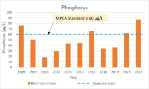
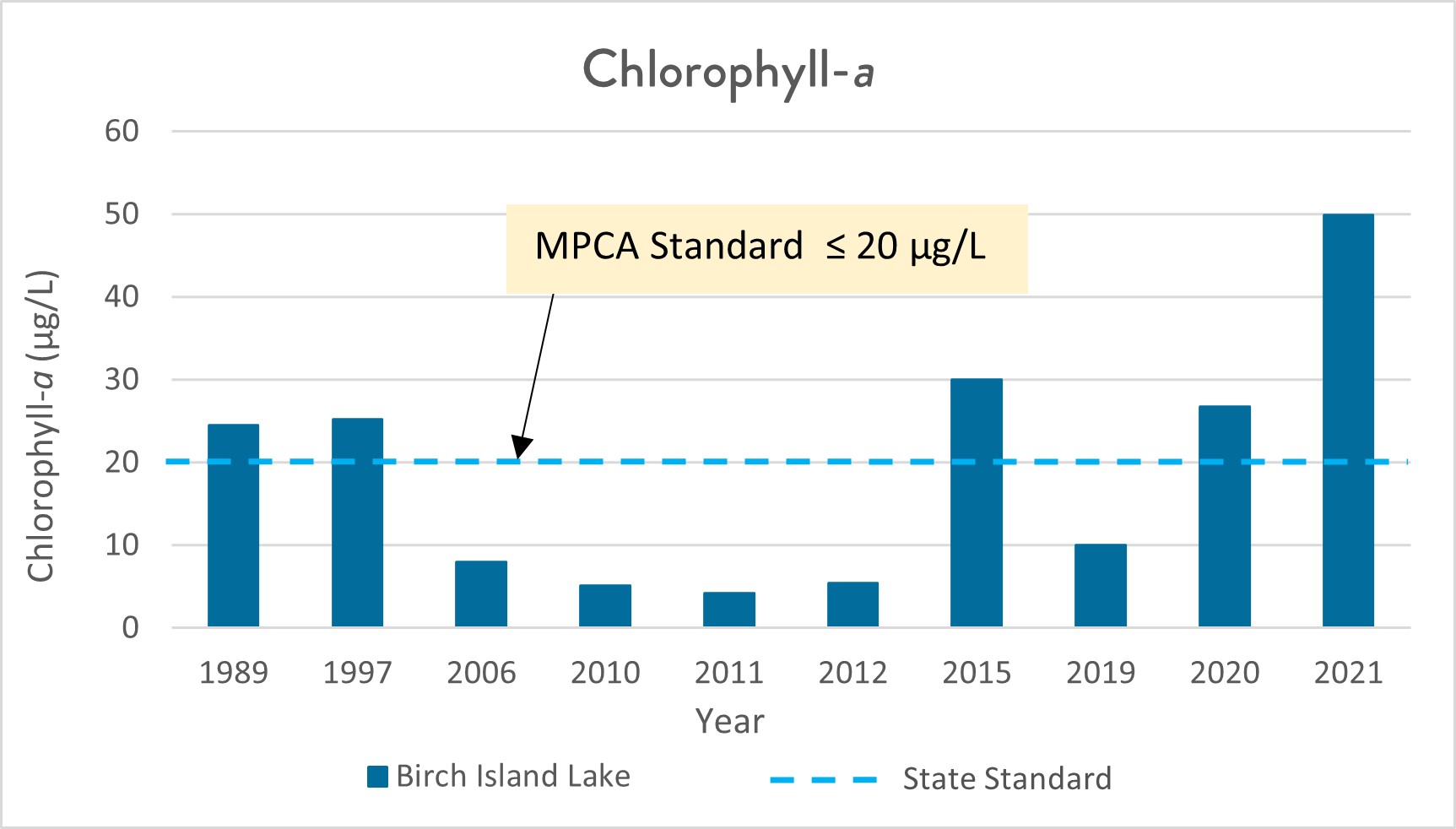
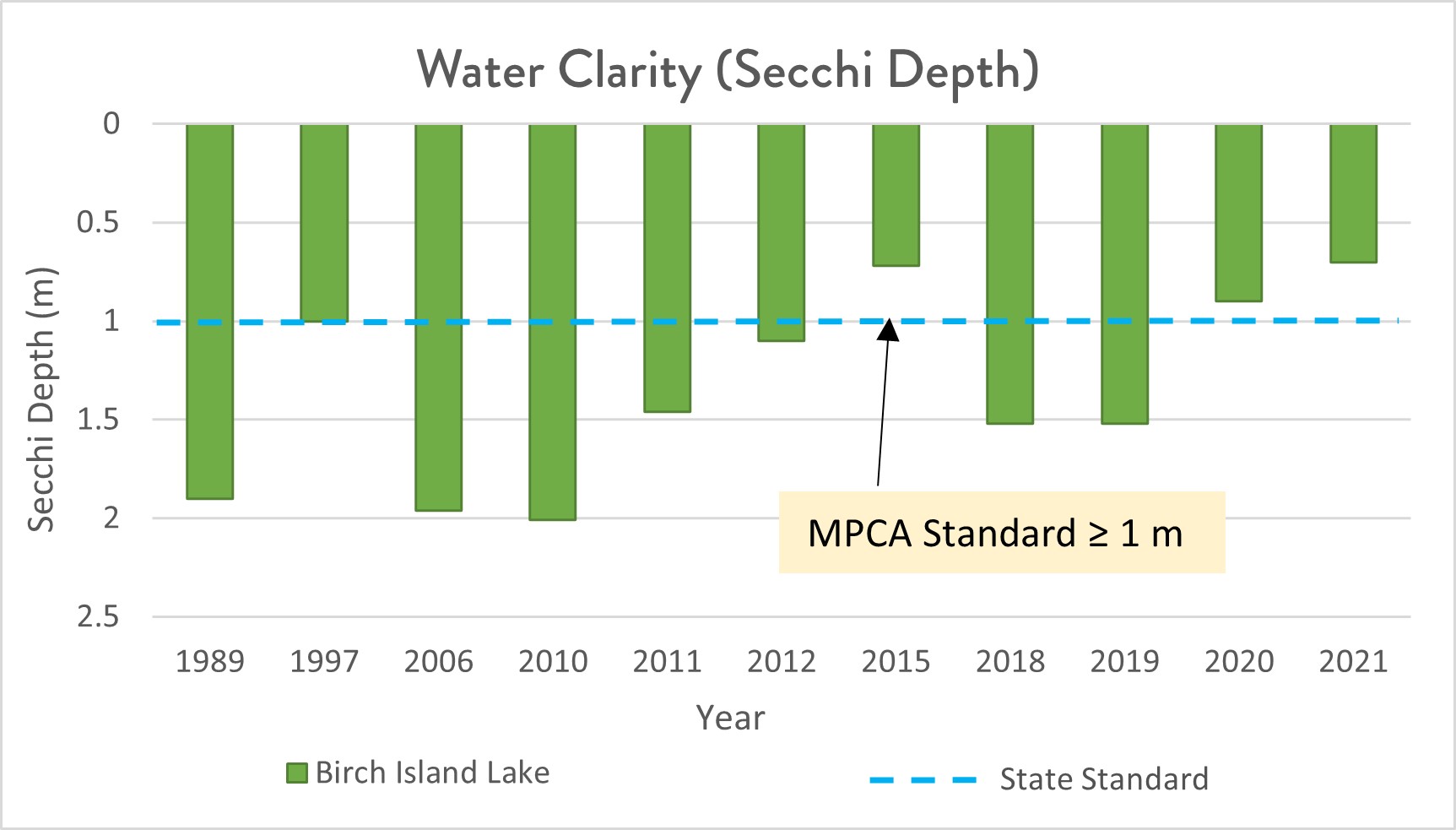
Water quality of Birch Island Lake is poor, with average nutrient levels higher than state standards for shallow lakes. Birch Island Lake does have a diverse range of aquatic plants present in the lake. There are a total of 12 different plant species. Typically the plant community in the western two thirds of the lake is primarily comprised of cattails and other wetland vegetation. However, heavy rainfall during June of 2014 raised the water level in the lake by 6 feet, causing cattails to die off. In 2015, the invasive species purple loosestrife was recorded in aquatic plant cataloging.
Printable Birch Island Lake Fact Sheet
Current Studies
The district conducted a lake water quality study to identify potential projects to help improve the overall health of the lake in 2023.
Learn more about the water quality study
Past Projects
In 2008, the Nine Mile Creek Watershed District installed a pipe to direct water from the area north of 62 into Birch Island Lake to help ease water levels that had been declining since the mid-1980s. The District also cleaned out and improved two existing stormwater basins and constructed a new stormwater pond to treat stormwater runoff prior to reaching Birch Island Lake to improve water quality. These projects were part of the larger Eden Prairie Lakes Water Quality Improvement Project.
For information about other past district projects, click here
Recreation



Nearby Birch Island Park has a hiking trail, picnic area, and playground. Birch Island Lake has canoe access.
Birch Island District Information and Walking Tour (PDF)
The Minnesota Department of Natural Resources may have additional information on the lake (including fishing regulations; location; water access sites; lake maps; lake reports on stocking, ice in/out and water quality; fish consumption; and aquatic plant surveys) if so, that information can be found here:
www.dnr.state.mn.us/lakefind/index.html
Downloadable water quality data can be found here: