Watershed-wide
Project Overview
The Nine Mile Creek Watershed District (NMCWD) is developing a Coordinated Flood Management Plan to identify strategies, projects, and partnerships that will help to reduce flood risk across the watershed.
Why This Plan is Needed
The Nine Mile Creek Watershed District (NMCWD) has a long history in flood planning and floodplain management going back to the 1960s and seeks to continue to be a leader in flood management. The NMCWD’s Coordinated Flood Management Plan will identify policies and actions related to reducing risk to public safety and permanent structures from flooding. This will include working with cities to address increased flood potential from Atlas 14 rainfall frequency estimates and understanding and addressing the potential for increased flood risk due to predicted changes in climate.
The Coordinated Flood Management Plan is intended to guide plan development, including modeling, project identification, and coordination strategies across the watershed. It will identify priority projects for NMCWD to implement in the near term, while also establishing a long-term framework for partner collaboration. The goal is to support coordinated efforts among cities, the county, and state agencies to address flood risks, protect natural resources, and deliver a sustainable regulatory and infrastructure response to increasing precipitation trends.
Vision Statement
Create a resilient, collaborative, and sustainable flood management plan across the watershed that addresses flooding concerns, reduces infrastructure risk, and balances environmental, economic, and safety needs.
Goal statement:
To enable coordination with partners, including cities, county, and state agencies, to address flood risks, preserve natural resources, and ensure a sustainable regulatory and infrastructure response to increasing precipitation trends.
Project Goals/Details:
Create a Coordinated Flood Management Plan
Develop a watershed-wide plan using the district’s flood model to guide cities and partners. The plan will prioritize areas at risk during a 100-year flood and outline both near-term projects and long-term strategies.
Increase Flood Storage
Identify and implement cost-effective opportunities to store water in upstream areas to reduce flooding downstream.
Improve Water Flow (Conveyance)
Upgrade and optimize infrastructure where storage isn’t feasible to help move water safely through the system.
Plan and Prioritize Projects
Create a clear timeline and sequencing strategy to help the district and partners coordinate when and where projects should happen.
Build Resilience into Redevelopment
Work with cities and developers to identify flood protection features in redevelopment projects, such as along transit corridors and large sites.
Build on Past Work
Incorporate previous flood studies and data to strengthen the plan.
Prepare for Flood Events
Develop a clear plan for how the district responds before, during, and after major flooding to protect public safety.
Use Data and Update Regularly
Update the plan at least every 10 years—or sooner as new data becomes available—to reflect changing conditions.
Project Updates:
Community Engagement:
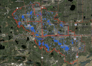
Explore the Nine Mile Creek Watershed District Flood Mapping Tool to better understand potential flood risks on your property. https://experience.arcgis.com/experience/0d42f081e1264c458045ad1692a644a4/page/Flooding?views=Flood-Risk-on-my-Property
Project Timeline:
2026
- March 2026: Project Initiation and Kickoff
- April 2026: Task 1: Existing Condition Model Updates
- June 2026: Task 2: Flood Characterization
- July 2026: Task 3: Part 1 Documentation
- July 2026: Task 4: Define Flood Protection Goals
- August 2026: Task 5: Integrate Previous NMCWD and Municipal Flood Studies
- October 2026: Task 6: Approximate Ultimate Runoff from Localized Flood Improvements
- December 2026: Task 7: Flood Management Scenario Analysis for Off-Creek Lakes
2027
- May 2027: Task 8: Flood Management Scenario Analysis for Creek
- June 2027: Task 9: Part 2 Documentation
- July 2027: Task 10: Implementation Sequencing Strategy
- September 2027: Task 11: Public Benefit and Cost-Benefit Analysis
- December 2027: Task 12: Development of Coordinated Flood Management Plan
Questions?
Contact Zach Stafslien, Regulatory Program and Project Manager, at p: 952-204-9690, e: zstafslien@ninemilecreek.org