Bloomington
ABOUT NORMANDALE LAKE
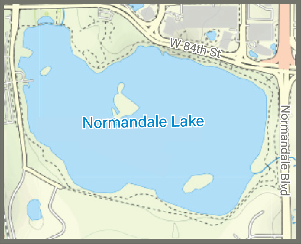
Normandale Lake, south of Interstate 494 in Bloomington, is a man-made lake. The District converted it to a lake from a wetland in the late 1970s for flood control. It is a shallow lake that receives water from six cities and over 21,000 acres of land.
Water Quality
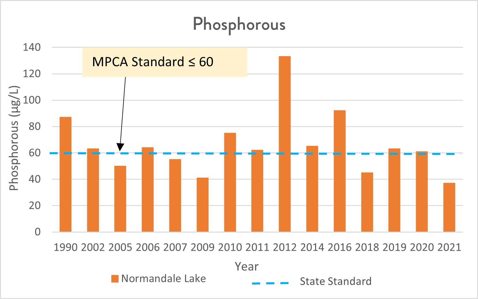
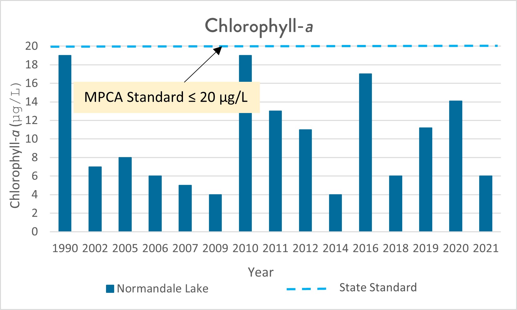
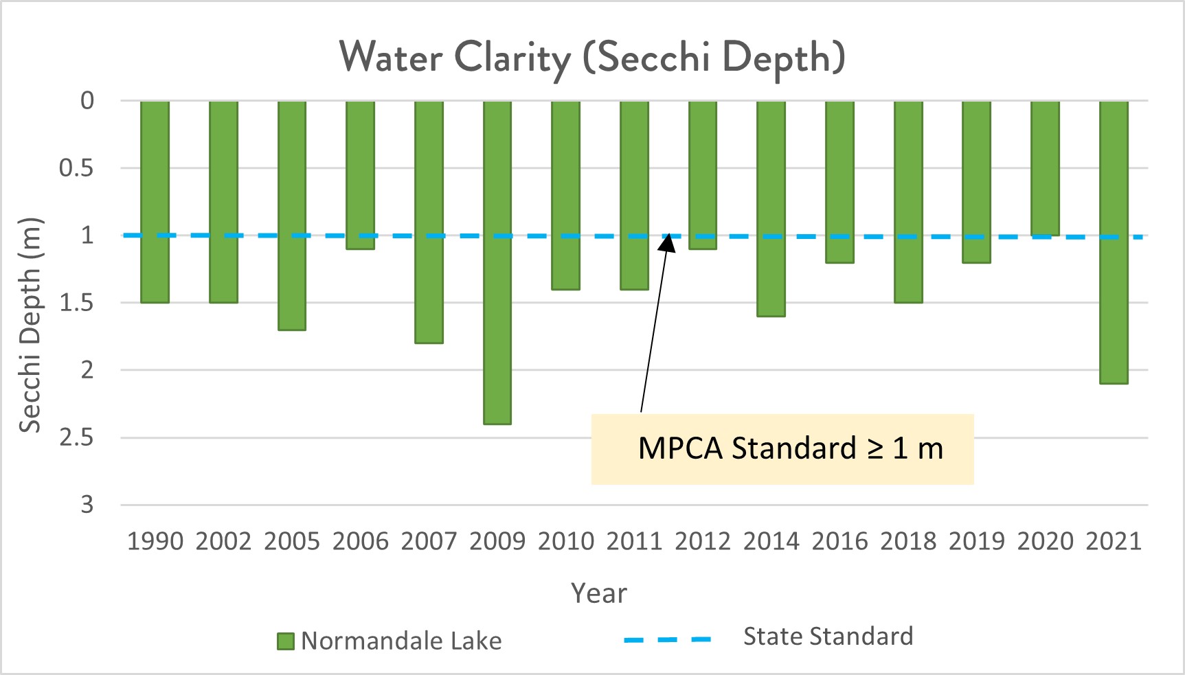
Normandale Lake currently meets state standards for two of the three water quality standards used to judge lake health. Currently it is not on the impaired waters list. Normandale Lake can have frequent algal blooms. These algal blooms can impede recreation due to odor and appearance. The District’s Normandale Lake Water Quality Improvement Project seeks to reduce the amount of phosphorus in the lake that fuels algae growth and reduce the amount of curly-leaf pondweed, an aquatic invasive species, in the lake.
Printable Normandale Lake Fact Sheet
Past Projects
Normandale Lake was created from a marsh flood plain along Nine Mile Creek in 1979. A control structure and dam along Normandale Avenue facilitated this major construction. Now Normandale Lake helps control water levels downstream by storing stormwater and releasing the excess water slowly.
Normdale and Marsh Lake Flood Control Fact Sheet
The Nine Mile Creek Watershed District and the City of Bloomington conducted a lake drawdown (August 2018-March 2019), alum treatment (May 2019), and herbicide treatment (May 2020) to improve the health of Lake Normandale. The project goals were to reduce the amount of curly-leaf pondweed, an invasive aquatic plant, and reduce phosphorus release from the lake bottom. Following the drawdown, aquatic plant monitoring in 2019 and 2020 showed reduced curly-leaf pondweed in the lake. Water quality monitoring and plant monitoring will continue to track project outcomes, including lake phosphorus levels. Herbicide treatments were completed yearly from 2020-2022 to target remaining curly-leaf pondweed in the lake. Herbicide treatments may be repeated in the future as we continue to track lake conditions. Click here for more information on Lake Normandale’s projects.
For information about other past District projects, click here
Recreation


Lake Normandale offers a wide variety of amenities. They include a 1.9 mile loop around the lake, many other trailheads, picnic areas, an amphitheater, and boat launch (limited to 6 horsepower). A variety of fish species live in the lake including: black bullhead, black crappie, bluegill, common carp, green sunfish, hybrid sunfish, pumpkinseed, and yellow bullhead.
The Minnesota Department of Natural Resources may have additional information on the lake (including fishing regulations; location; water access sites; lake maps; lake reports on stocking, ice in/out and water quality; fish consumption; and aquatic plant surveys) if so, that information can be found here:
https://www.dnr.state.mn.us/lakefind/index.html
Downloadable water quality data can be found here:
https://www.pca.state.mn.us/water/water-quality-data